-
New Zealand Topo Maps
- Category:Travel
- Updated:2025-11-21
- Rating: 4.3
Introduction
Discover the ultimate outdoor navigation companion with this user-friendly app featuring the latest topographic maps of New Zealand, Cook Islands, and Tokelau. Offering a wide range of mapping options akin to popular GPS handhelds, this app allows you to effortlessly create and edit waypoints, track your progress with detailed statistics, import/export GPX files, and explore various base map layers including topomaps, nautical charts, aerial imagery, and more. From hiking and biking to camping and skiing, this app caters to all outdoor enthusiasts. Preload map data for offline use and unlock even more features with the pro version. Get ready to embark on your next adventure with this essential navigation tool.
Features of New Zealand Topo Maps:
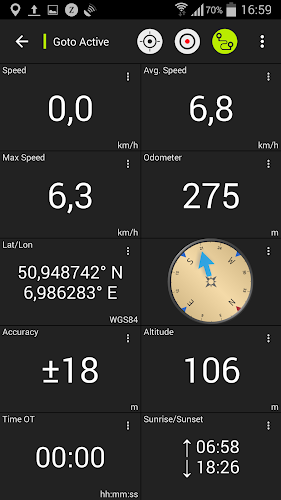
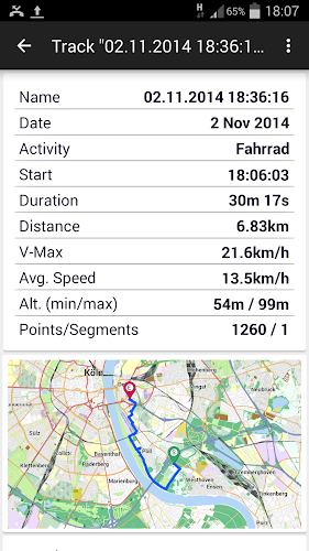
Comprehensive Navigation Features: This app offers a wide range of features for outdoor navigation, such as creating/editing waypoints, track recording, tripmaster with various data fields, and GPX and KML import/export options.
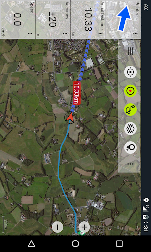
Diverse Base Map Layers: With access to topomaps, nautical charts, aerial imagery, Google Maps, Open Street Maps, Bing Maps, and ESRI Maps, users have a variety of map options to choose from.
Overlay Layers for Additional Information: Users can overlay public conservation areas, hunting areas, DOC camp sites, huts, tracks, and restrictions, providing valuable information for outdoor activities.
Offline Accessibility: The app allows users to preload map data for areas without cell service, ensuring continuous access to navigation tools even in remote locations.
FAQs of New Zealand Topo Maps:
Are there limitations in the free version of New Zealand Topo Maps? Yes, the free version includes ads and restrictions on the number of waypoints, tracks, routes, and import/export options.
How can users provide feedback or make feature requests? Users can send comments and feature requests to the provided email address, [email protected]
What sets the topographic maps in this app apart from others? The topographic maps in this app are created by Land Information New Zealand (LINZ) and are used by New Zealand emergency services for various purposes, ensuring accuracy and reliability.
Conclusion:
With a wide range of navigation features, diverse map options, additional overlay layers, and offline accessibility, this outdoor navigation app provides users with everything they need for a successful outdoor adventure. Whether hiking, biking, camping, or engaging in other outdoor activities, this app is a valuable tool for navigation and exploration. Download New Zealand Topo Maps now to enhance your outdoor experience in New Zealand, the Cook Islands, and Tokelau.
Information
- Size: 30.92 M
- Language: English
- Version: 7.2.2
- Requirements: Android
- Ratings: 64
- Package ID: com.atlogis.nzmaps.free
- Developer:


